28th Jul, 2021 10:30 GMT/BST
Books, Maps & Manuscripts

4
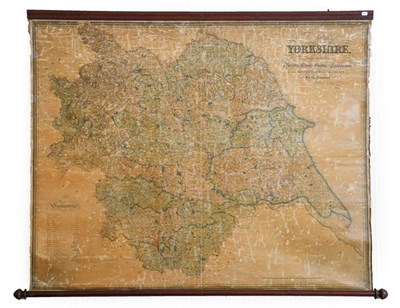
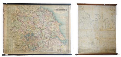
Hobson (William Colling). This Map of Yorkshire, is most respectfully dedicated to the...
Hobson (William Colling). This Map of Yorkshire, is most respectfully dedicated to the Nobility, Clergy, Gentry, Landowners, and Manufacturers of the County, by the Proprietor, York: published by William Colling Hobson, 1843, large engraved map on 4 sheets of glazed card, showing features including navigable canals, turnpike roads and railways, laid on linen and mounted on wooden rollers, overall discolouration, 1200 x 1550 mm, together with 2 similar large maps on rollers (Bacon's Excelsior Map of Yorkshire and Parts of Adjoining Counties, showing Railways, Roads, Elevations and Distances, also Local Government Divisions, London & Manchester: G. W. Bacon & Co. Ltd., and an untitled map of Dalton upon Tees and environs) (qty: 3)
Not SoldEstimated at £100 - £150
Auction: Books, Maps & Manuscripts, 28th Jul, 2021
Books, Maps & Manuscripts
Sell one like this
If you've got a similar item to sell, complete the valuation form below and one of our experts will get in touch.

